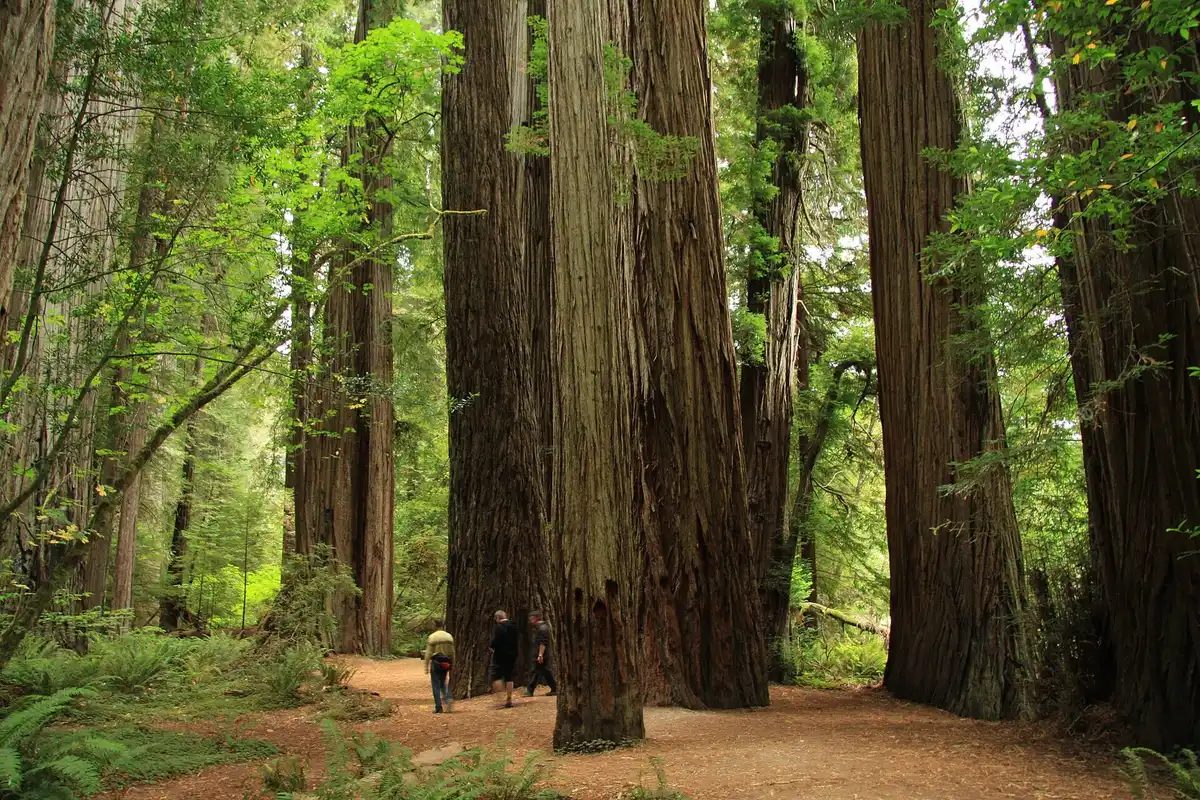
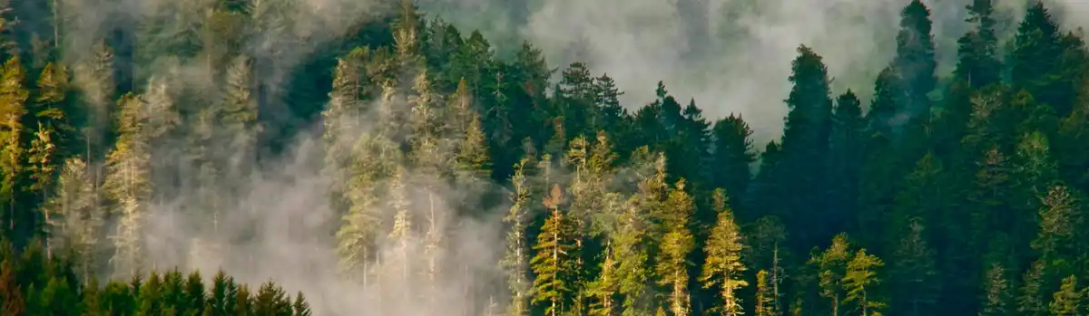
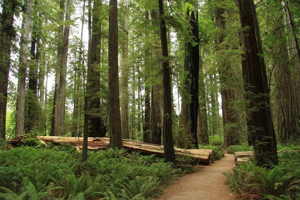
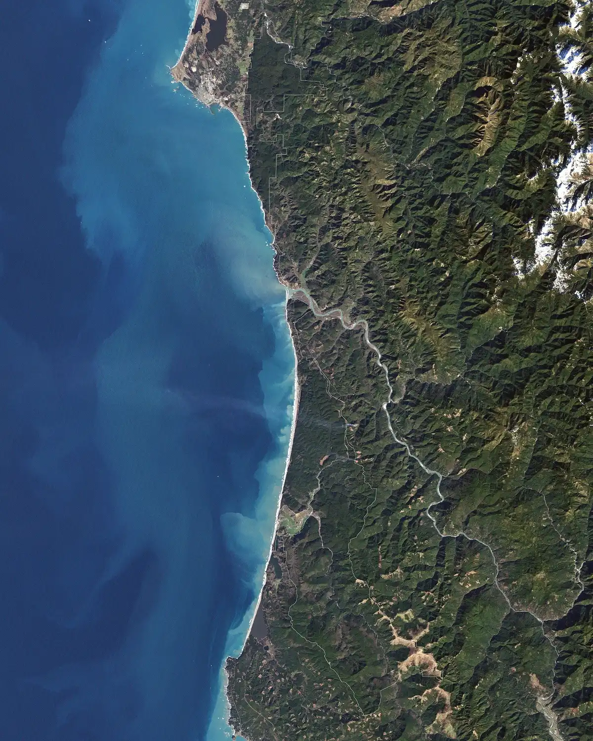
Fog in a coast redwood forest

Pick your adventure

Redwoods, reefs, and the river out front

Turn one way for giant trees, the other for sea stacks. The Smith River is basically in the yard. Pick a day, then check the official page — trails, tides, and helicopters all change their minds.

Hero photo: CC BY-SA 4.0 — Dwatsonfam

Four parks, one forest

Wander the giants

Redwood National and State Parks is run together by the National Park Service and California State Parks. It is a World Heritage Site and a biosphere reserve, and it protects about 45% of California’s remaining old-growth coast redwoods.

Renowned for the world’s tallest trees… landscapes span from open prairies and oak woodlands to pristine rivers and untamed coastline.

NPS homepage
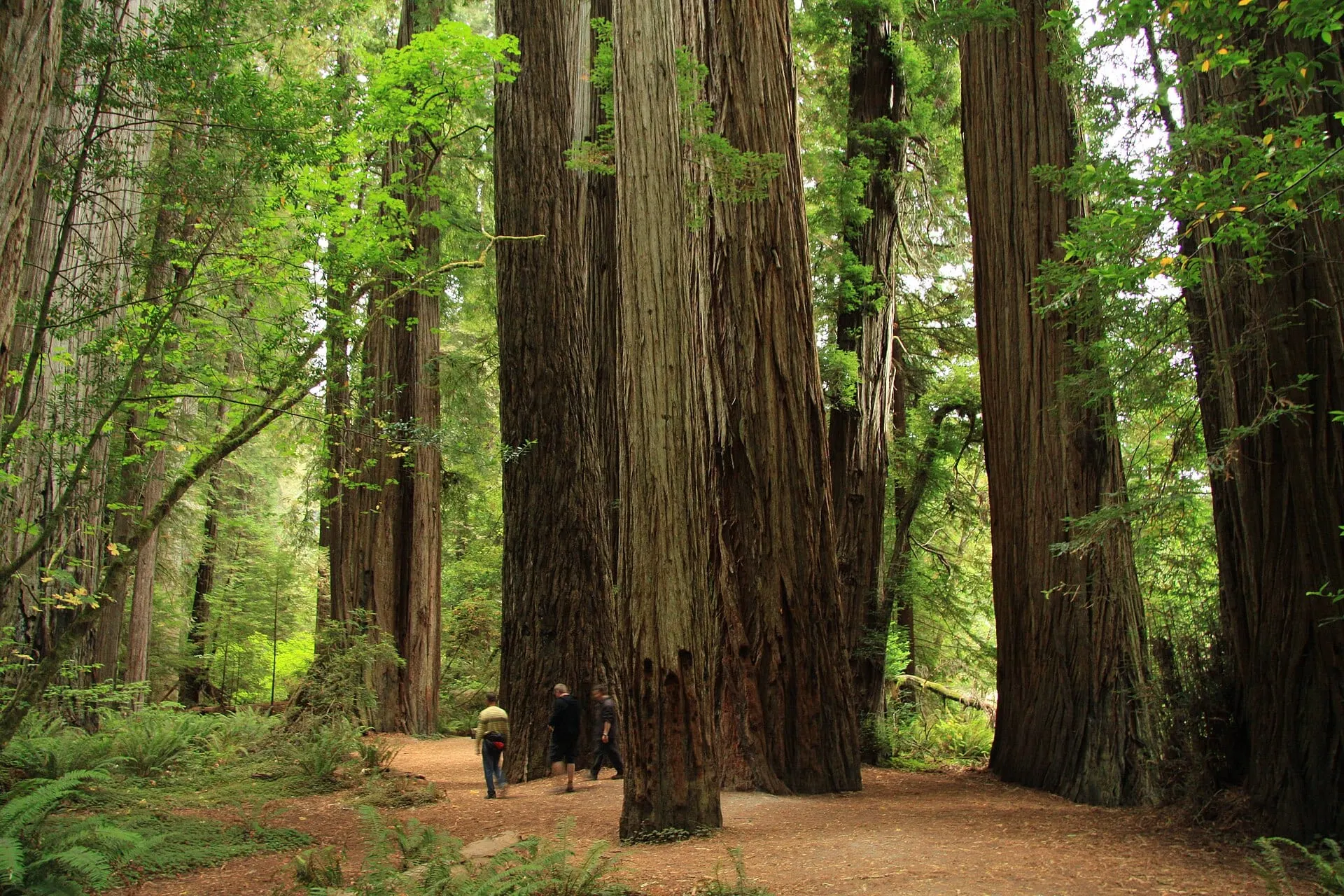
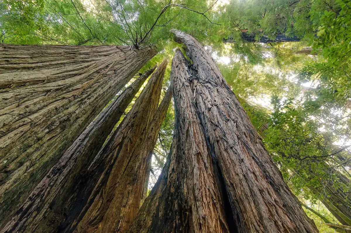
Huge coast redwoods in Stout Memorial Grove, Jedediah Smith Redwoods State Park

About 10,000 acres · 9 miles east

Jedediah Smith Redwoods State Park

Old-growth redwoods about 9 miles east of Crescent City on Highway 199. Stout Grove, Grove of Titans, and Boy Scout Tree Trail are all on Howland Hill Road. Simpson-Reed and the Hiouchi Trail are in here too, and the Smith River runs through.

CC BY-SA 3.0 — Chmee2

State park page
Damnation Creek Trail in Del Norte Coast Redwoods State Park

About 6,400 acres · since 1929

Del Norte Coast Redwoods State Park

Set aside around 1929. About half is old-growth coast redwood, with roughly 8 miles of wild shoreline. Damnation Creek Trail drops through the forest to that coast. Most of the shore is steep, so you reach it on foot.

CC BY 2.0 — Katie Thebeau

State park page
Fern-covered walls in Fern Canyon, Prairie Creek Redwoods State Park

About 25 miles south of Crescent City

Prairie Creek Redwoods State Park

About 50 miles north of Eureka and 25 miles south of Crescent City. This is the Fern Canyon, Roosevelt elk meadow, and Newton B. Drury Scenic Parkway part of the day.

CC BY-SA 2.0 — Ken Lund

State park page
Fog in the redwoods, from the Redwood National and State Parks homepage banner

Tall Trees, Lady Bird, Enderts Beach

Redwood National Park

The national park side of the partnership. Tall Trees Grove, Lady Bird Johnson Grove, and the Enderts Beach coast sit with the state parks under one visitor plan.

Public domain — National Park Service

NPS park home

Print this, don’t trust the pin

Official park maps

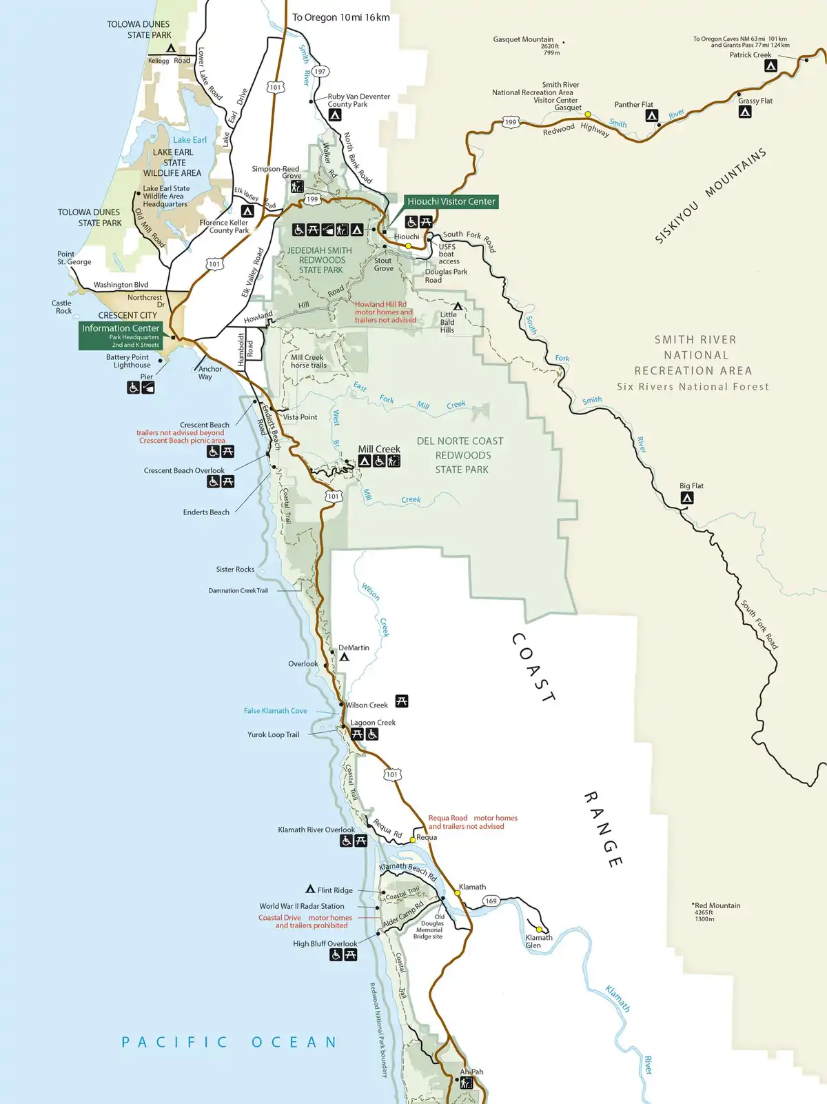
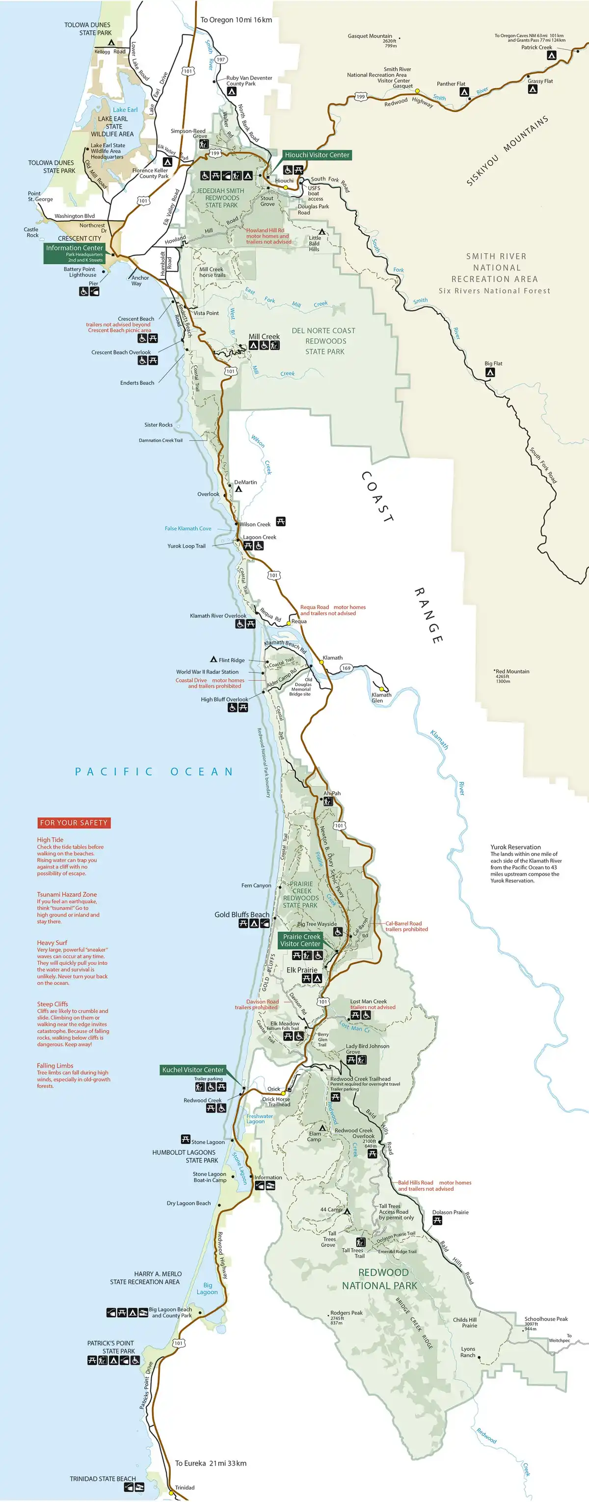
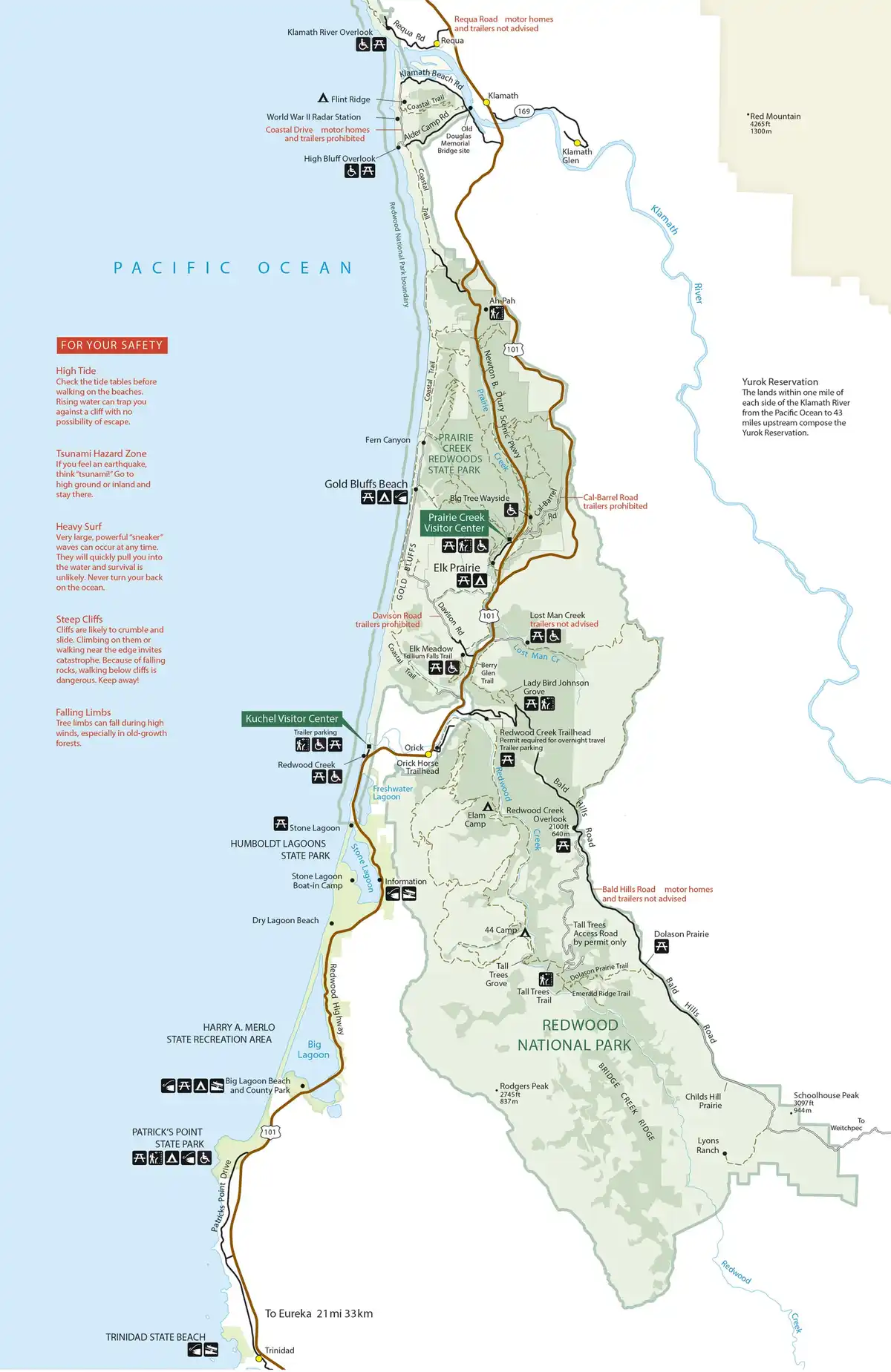
The first map runs from the Oregon line and Brookings down to Eureka. The gold pin is Arky's B&B. Jedediah Smith Redwoods State Park, with Stout Grove and Hiouchi, is about a 30-minute drive on US-101, CA-197, and US-199. Drive minutes start here. After this map, the public-domain park maps. NPS says a lot of commercial GPS is unreliable under the trees, so open an official JPEG or PDF before you go.

Hand-picked walks

Trails that fit a real day

Mileage and difficulty follow the NPS trail pages. Seasonal bridges, downed trees, and permits change — check Current Conditions before you lace up.

Coast redwoods and sword ferns in Stout Memorial Grove

0.5-mile loop Easy — downhill from the car, then flat

Jedediah Smith Redwoods State Park

Stout Memorial Grove

On Howland Hill Road — often called the heart of Jedediah Smith. In 1929 Clara Stout gave about 44 acres in memory of her husband. The loop passes huge redwoods whose flared bases sit partly buried in Smith River flood silt, with sword ferns underfoot and a short spur to the bank.

Trailhead. Paved spur at the east end of Howland Hill Road. In summer a seasonal bridge can also connect from Jedediah Smith Campground.

CC BY-SA 3.0 — Chmee2

jedediah
Stand-in: Howland Hill Road through Jedediah Smith Redwoods, near the Grove of Titans trailhead

1.5-mile loop Grades and metal stairs

Jedediah Smith Redwoods State Park

Grove of Titans

A newer trail on Howland Hill Road, between Stout Grove and the Boy Scout Tree Trail. We love this one — an elevated boardwalk leads through a grove of huge, strangely shaped redwoods. Stay on the boardwalk so we all keep protecting the forest floor.

Trailhead. East side of Howland Hill Road, between Stout Grove and the Boy Scout Tree Trail. Marked trailhead; parking is limited.

Stand-in photo until we have a Grove of Titans boardwalk shot. This frame is from nearby Howland Hill Road.

Public domain — Grogan, Brian (HAER). Stand-in from Howland Hill Road

jedediah
Redwood trunks along the Boy Scout Tree Trail

2.8 miles one way Moderate, with steep bits and switchbacks

Jedediah Smith Redwoods State Park

Boy Scout Tree Trail

Also on Howland Hill Road. Give it at least half a day. It goes deep into old growth and ends at Fern Falls. Around 2.5 miles an easy-to-miss spur reaches the double-trunk Boy Scout Tree. NPS warns this trailhead sees a lot of theft. As of August 2026 a downed tree near 1.75 miles could be scrambled over — that changes, so check Current Conditions.

Trailhead. North side of Howland Hill Road, signed, with a parking area.

CC BY 2.0 — Chris Rycroft

jedediah
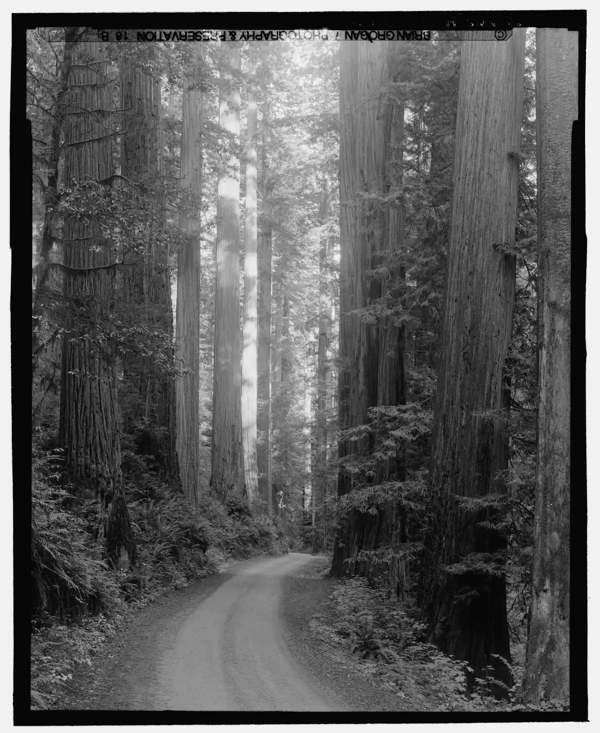
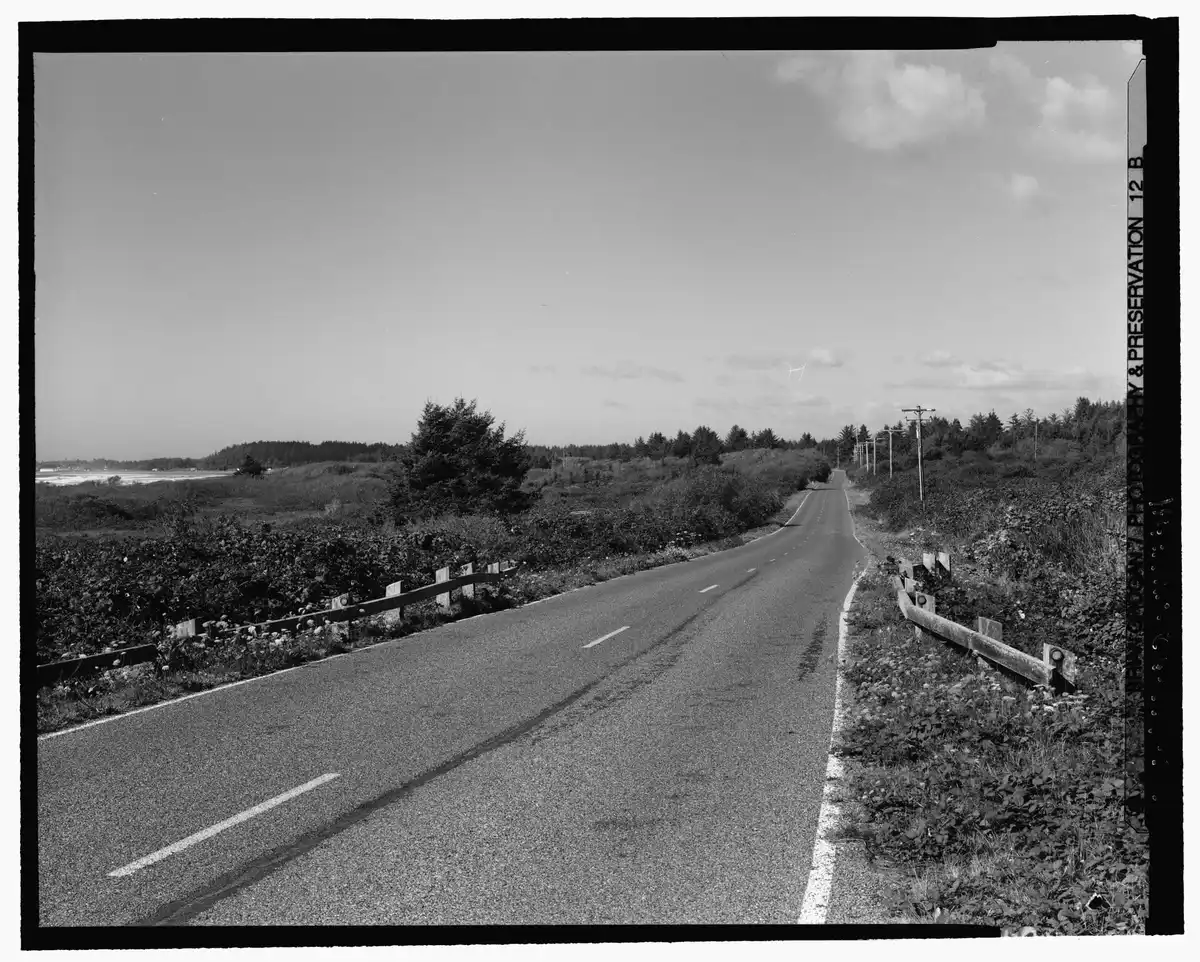
Historic view looking along Howland Hill Road through Jedediah Smith Redwoods

About 10 miles one way Narrow dirt road — a drive, not a hike

Jedediah Smith Redwoods State Park

Howland Hill Road

The classic drive-through-the-giants. About 10 miles one way and about 45 minutes, mostly unpaved. RVs, trailers, and big rigs do not fit. Stout Grove, Grove of Titans, and Boy Scout Tree trailheads are along it.

Trailhead. Scenic drive between Crescent City and Highway 199 near Hiouchi. See the NPS scenic drives page.

Historic HAER photo of Howland Hill Road, not a current road shot.

Public domain — Grogan, Brian (HAER)

jedediah drive
Redwood grove used as a stand-in for Simpson-Reed Trail; the photo is Stout Memorial Grove

1-mile loop Easy and level (barrier free)

Jedediah Smith Redwoods State Park

Simpson-Reed Trail

A family walk under redwoods more than a thousand years old. Creeks and fallen logs make little stair-steps and pools. Current Conditions listed it Open when this page was drafted.

Trailhead. Walker Road, about 0.1 mile north of Highway 199, on the east side.

Stand-in photo: this is Stout Memorial Grove, not a labeled Simpson-Reed view. Swap it when you have a trail photo.

CC BY-SA 3.0 — Chmee2. Stand-in from Stout Grove

jedediah
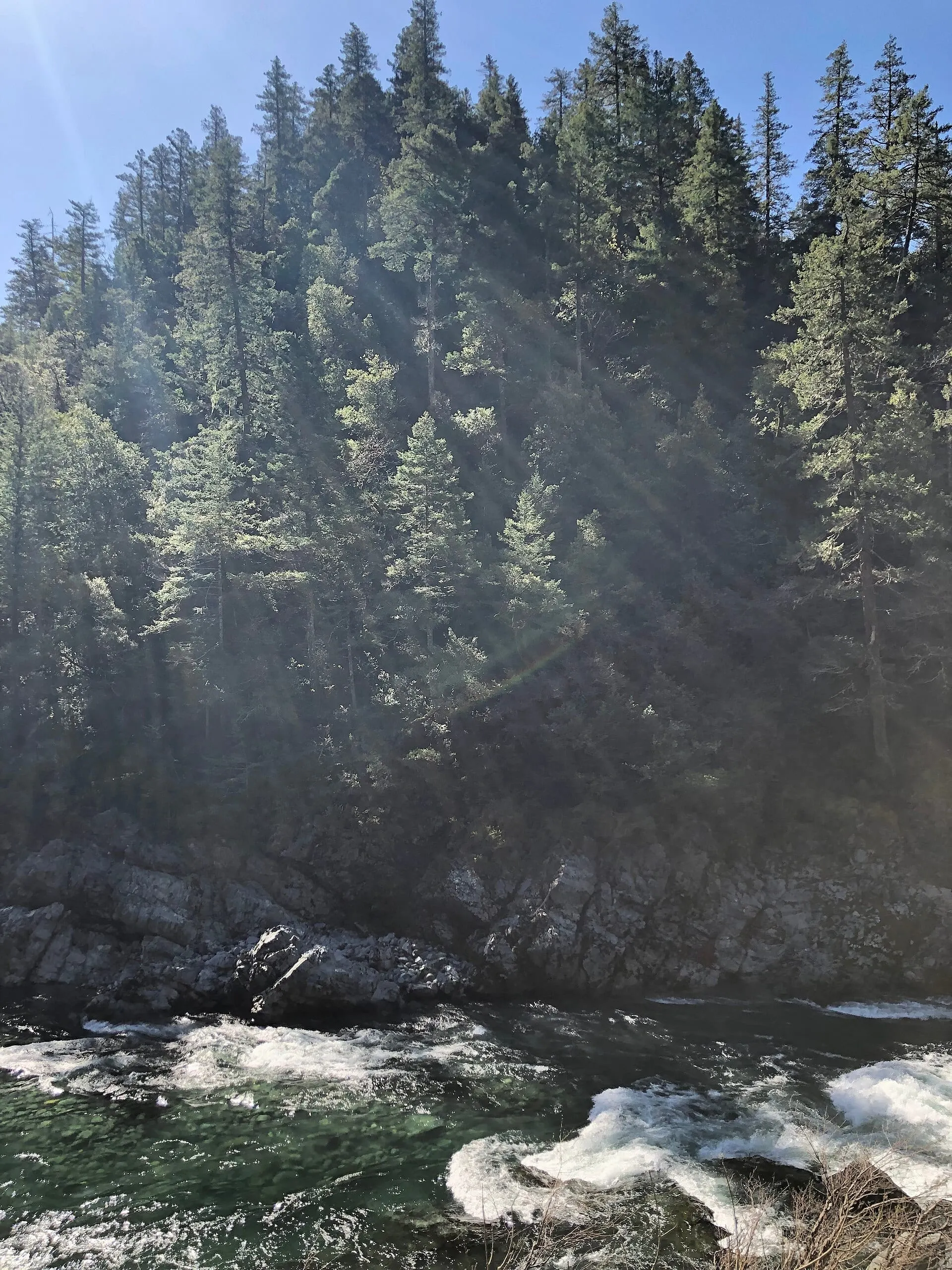
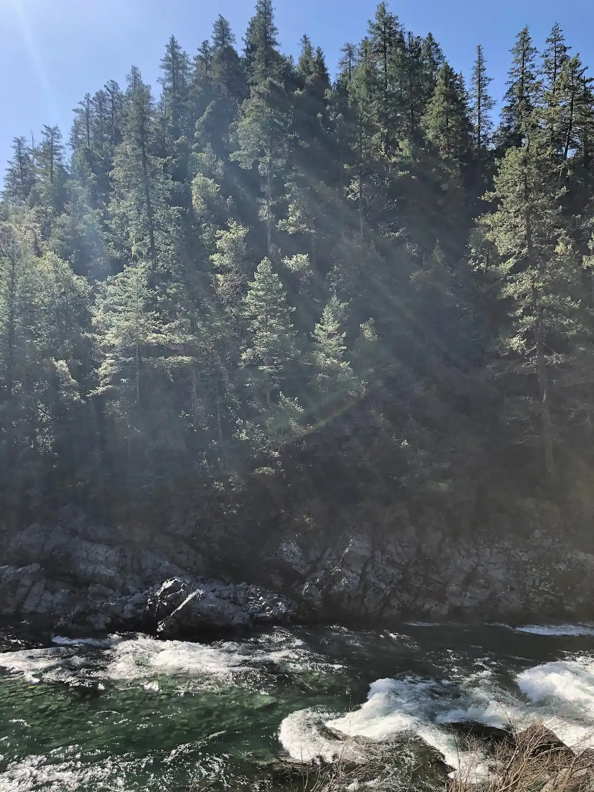
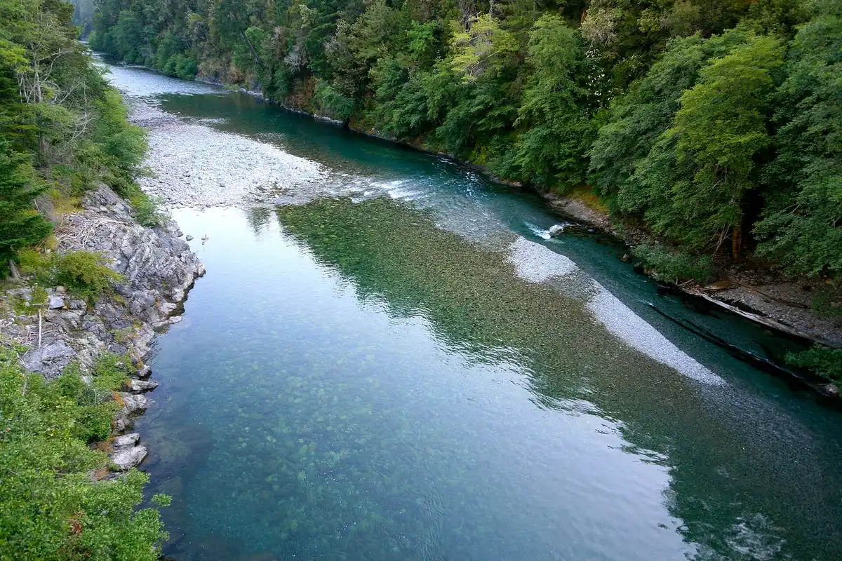
Forested slope above rapids on the Smith River in the Smith River National Recreation Area

2 miles Moderate, uneven, not steep

Jedediah Smith Redwoods State Park

Hiouchi Trail

Follows the clear Smith River, mixing riverbank forest with old-growth redwood. Rangers and visitors both like this one.

Trailhead. Just before the west end of the Highway 199 Hiouchi Bridge. In summer you can also come from the campground seasonal bridge, or via the Hatton Trail.

River photo from Smith River National Recreation Area, not taken on the Hiouchi Trail itself.

CC0 — Z3lvs

jedediah
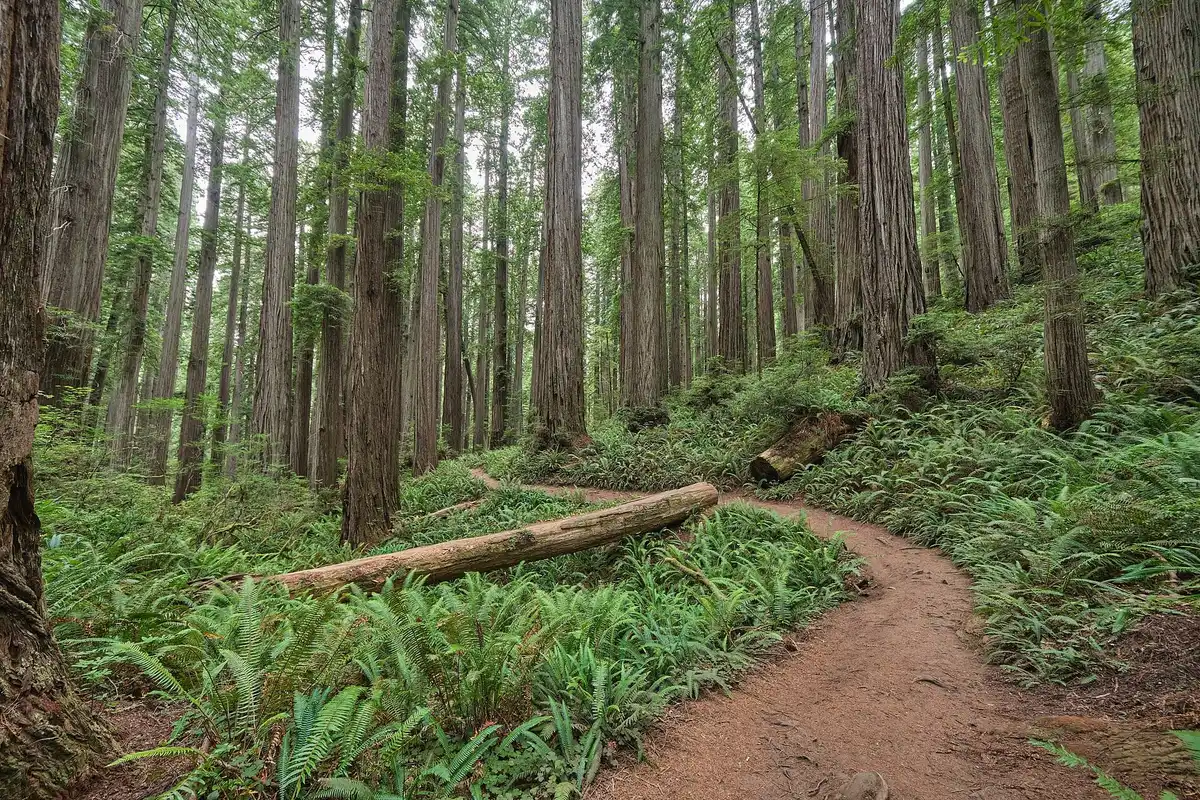
Trail through redwoods on the Damnation Creek Trail

2.2 miles one way Strenuous — about 1,000 feet down

Del Norte Coast Redwoods State Park

Damnation Creek Trail

From old-growth redwood down to a rocky Pacific shore, about a 16% grade. Go at a low tide if you want tide pools, and leave the animals alone. NPS also warns about theft at the trailhead.

Trailhead. Highway 101 at milepost 16.0. Parking is limited.

CC BY 2.0 — Katie Thebeau

del-norte
Historic road view toward Enderts Beach, with the beach to the left

About 0.6 mile one way Moderate, with some steep grades

Redwood National Park

Enderts Beach

A short walk to tide pools, with signs about how the coastal forest hangs on. Also a good spot to watch the ocean and look for whales. The last stretch is the Coastal Trail’s Last Chance / Enderts section.

Trailhead. End of Enderts Beach Road, about 3 miles south of Crescent City. A longer Coastal Trail continues from here.

Historic HAER view of Enderts Beach Road, with the beach off to the side.

Public domain — Grogan, Brian (HAER)

national
Fern Canyon walls in Prairie Creek Redwoods State Park

0.7-mile loop Uneven, not steep

Prairie Creek Redwoods State Park

Fern Canyon Loop

Fern walls about 30 feet high. You may get wet feet any time of year, and you may climb over or under fallen logs. A seasonal bridge is up in summer. Davison Road limits vehicle length and width, and trailers are not allowed. A summer permit or vehicle reservation is required. Check the official park site for the current dates.

Trailhead. Fern Canyon parking at the end of Davison Road. James Irvine Trail is the long way, about 10 miles round trip.

CC BY-SA 2.0 — Ken Lund

prairie
Redwoods in Tall Trees Grove, Redwood National Park

4.5 miles round trip Moderate to strenuous

Redwood National Park

Tall Trees Trail

The first 1.5 miles drop about 800 feet. A free online permit is required all year for parking and the access road. With the drive, plan on at least 4 hours. No RVs over 21 feet and no trailers.

Trailhead. Bald Hills Road to the locked Tall Trees Access Road. The permit email includes the gate code.

Public domain — Redwood National and State Parks

national
Redwood National Park forest scene used as a stand-in for Lady Bird Johnson Grove

1-mile loop Easy and level

Redwood National Park

Lady Bird Johnson Grove

A gentle loop near where the national park was dedicated. Rhododendrons show up in spring, and maple color in fall.

Trailhead. Bald Hills Road, about 2 miles from Highway 101. No RV or trailer parking.

Generic Redwood National Park photo, not labeled as the Lady Bird Johnson Grove trail. Prefer an NPS photo when you have one.

Public domain — NASA Goddard Space Flight Center

national

Brookings, then the cliffs

Chase the sea stacks

Samuel H. Boardman State Scenic Corridor is about 12 miles of Highway 101 between Brookings and Gold Beach, tying together about 18 miles of the Oregon Coast Trail. Hike the whole thing, or hop stop to stop.

Cliffs, tucked beaches, sea stacks. Gray whales pass in winter and spring along the Pacific Flyway. Harris Beach management unit: 541-469-0224. Oregon State Parks: 800-551-6949.

The state brochure flags tides, cliffs, and sneaker waves. Read it before you scramble down anything.

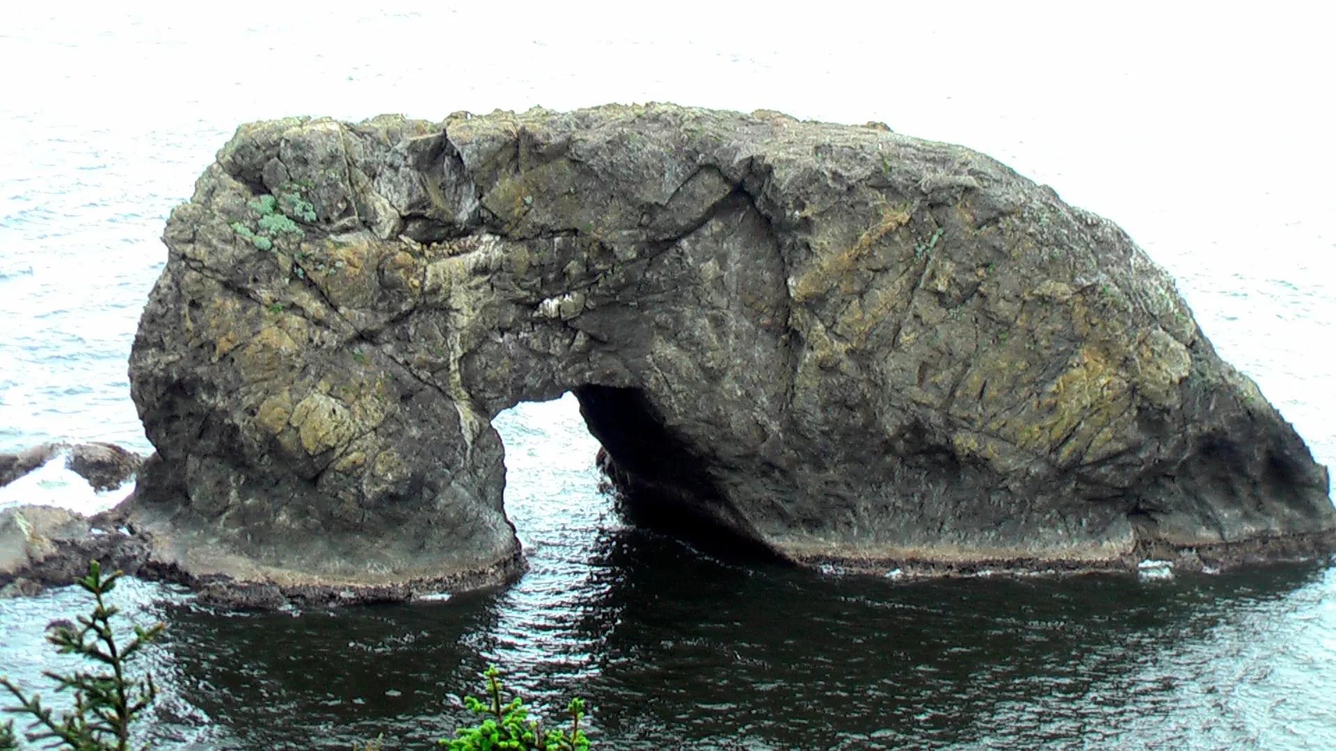
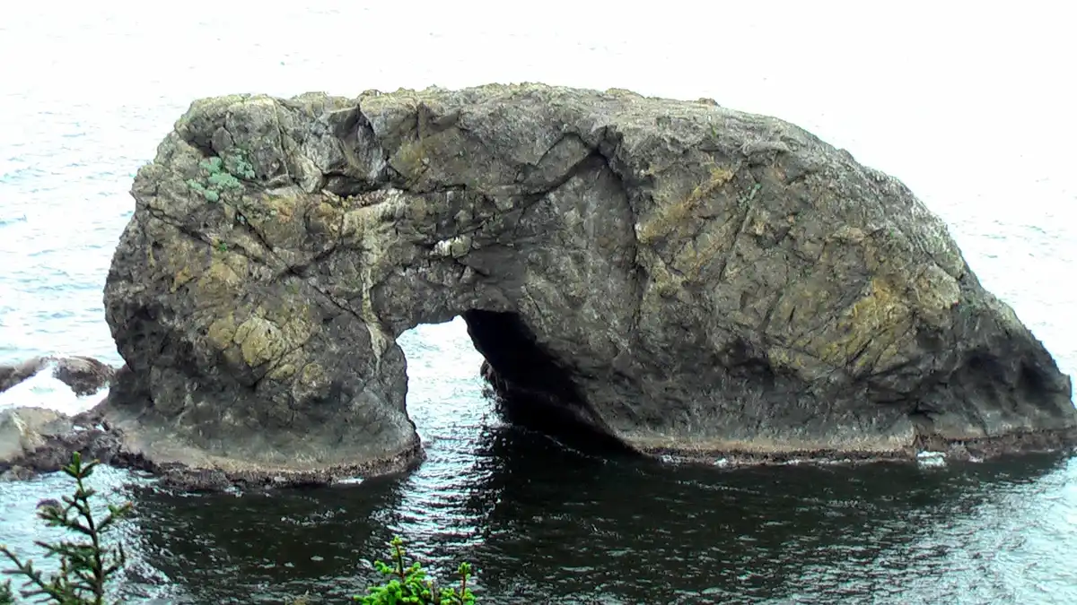
Arch Rock and offshore rocks in Samuel H. Boardman State Scenic Corridor

Short paved path

Arch Rock

A short paved walk to a viewpoint of sea stacks and islands strung along the shore.

CC BY 2.0 — Rick McCharles

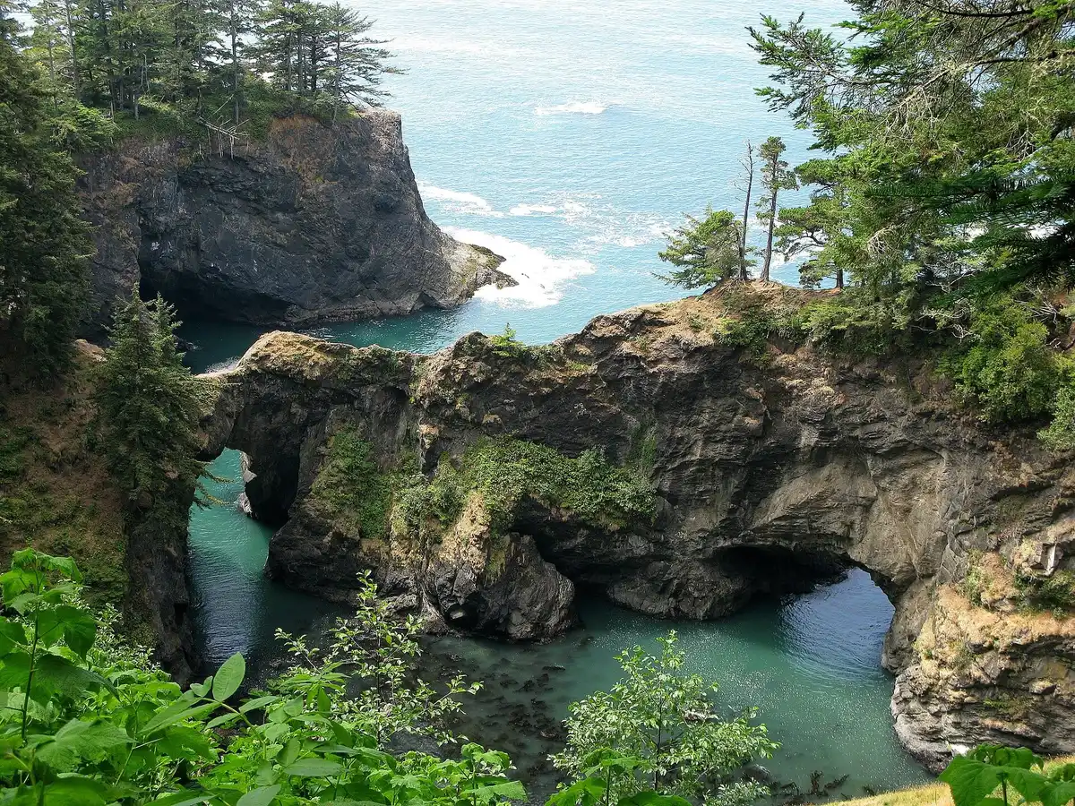
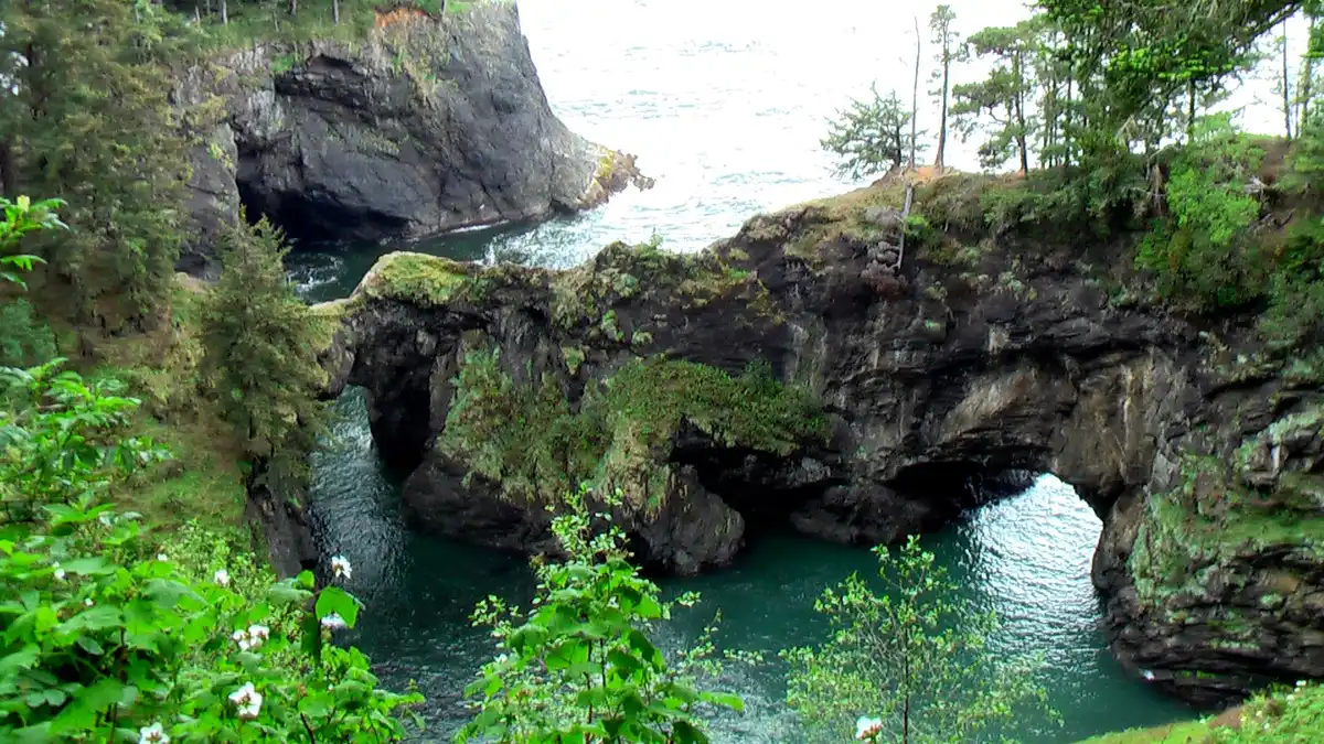
Natural Bridges as the fog clears

One of the best views

Natural Bridges

A short trail to seven rock arches and blowholes, plus a memorial to Samuel Dicken, who imagined the Oregon Coast Trail.

CC BY 3.0 — regstrat

Whaleshead Beach in the Samuel H. Boardman corridor

Beach or overlook

Whaleshead

The north picnic area has a flatter gravel path down to the beach. The south viewpoint is a steeper drop.

CC BY 4.0 — Gary Halvorson, Oregon State Archives

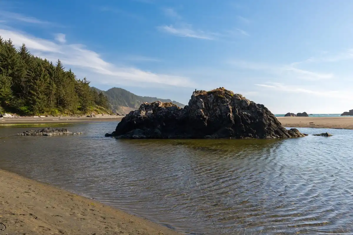
Coast in Samuel H. Boardman State Scenic Corridor, used as a stand-in for House Rock Viewpoint

Named for the first parks chief

House Rock

A memorial to Samuel H. Boardman, the first Oregon State Parks superintendent. Between here and Cape Ferrelo is about 4 miles of cliff-top trail, with spurs down to hidden beaches.

Stand-in: a Boardman corridor coast photo, not a shot labeled House Rock Viewpoint.

CC BY 2.0 — Rick McCharles

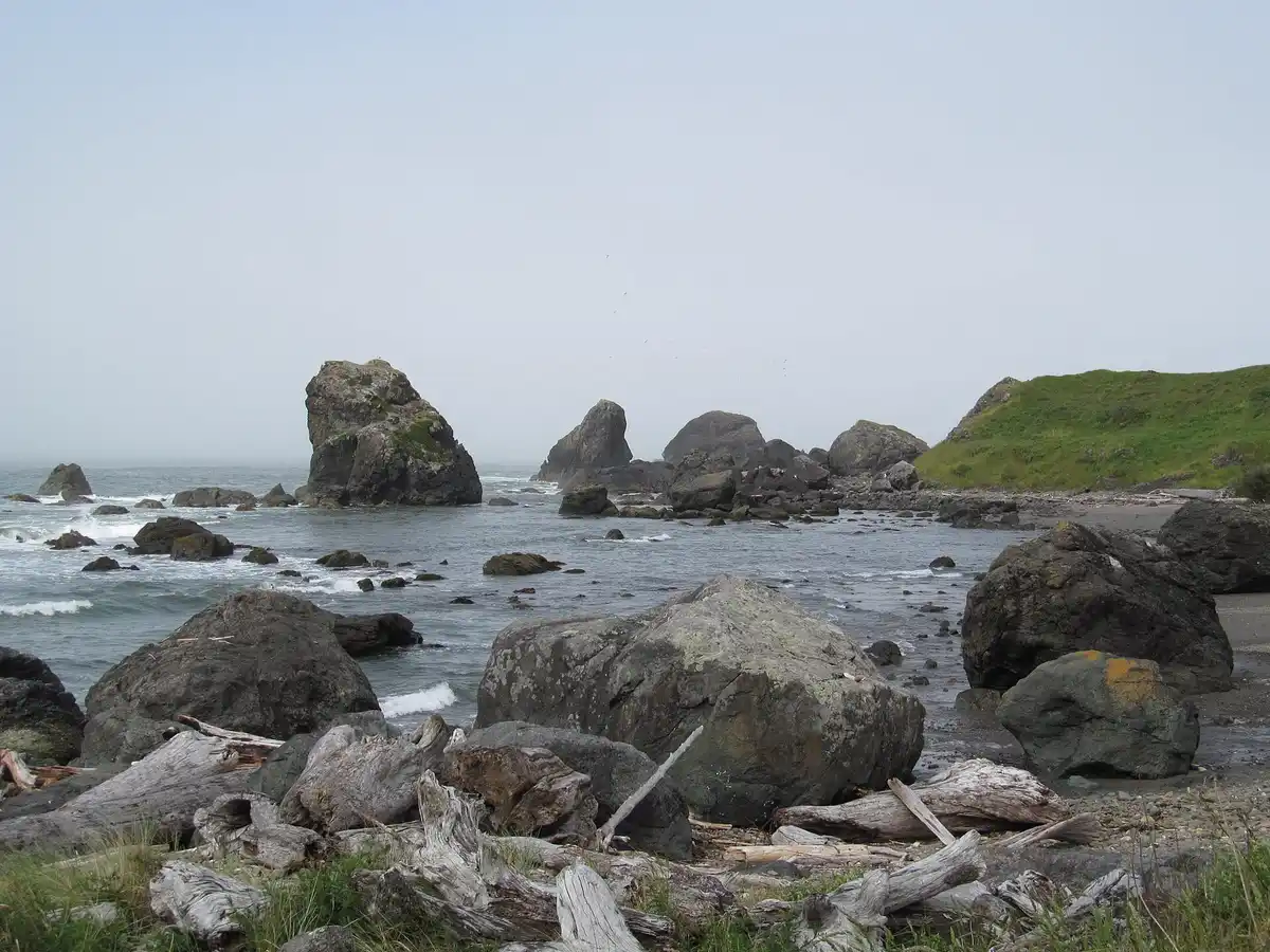
Coastal view in Samuel H. Boardman State Scenic Corridor

About a 1-mile loop

Cape Ferrelo

A loop out to the headland. People come for sunset, and for gray whales in fall and spring.

Corridor view. The photo is not labeled specifically as the Cape Ferrelo overlook.

CC BY-SA 2.0 — Dougtone

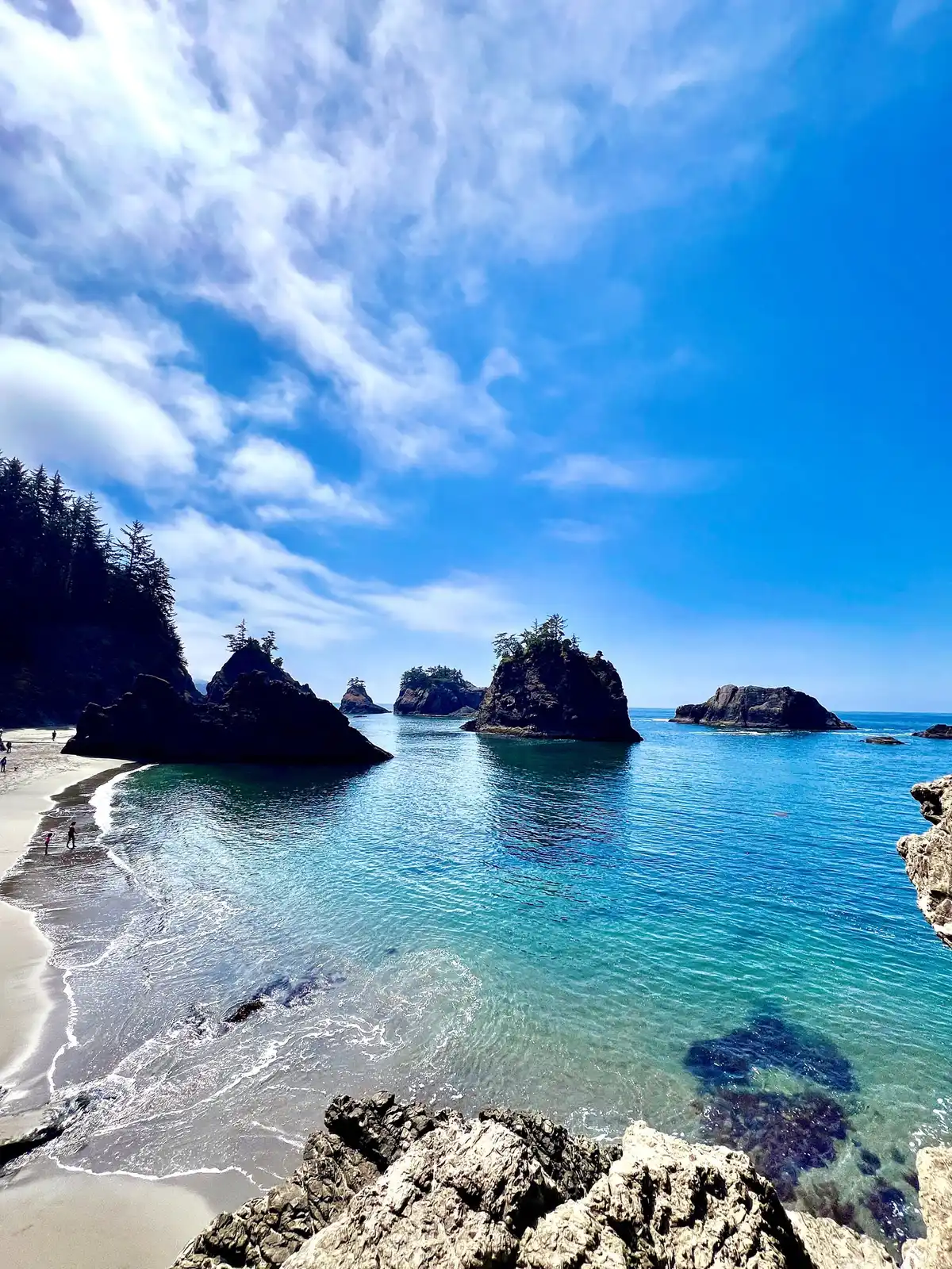
Secret Beach in the Samuel H. Boardman corridor

Local nickname

Secret Beach

Not a name on the official highlight list. It is a beach you hike down to inside the corridor. Use the official map and the tide, and watch the cliffs and big waves.

Local nickname. Follow the official map, not just the sign in someone’s caption.

CC BY 2.0 — Oregon Department of Transportation

The river is the neighbor

Float the Smith

The Smith is one of California’s longest undammed mainstem river systems, and a National Wild and Scenic River. Jedediah Smith campground and day-use area make an easy river base. Business photos stay on their own sites.

Smith River Kayaks

Also called Chetco Smith River Kayaks. The company says it has been at it since 1996: self-guided rentals with shuttle, gear, and route notes. Trips they describe include the estuary, redwood stretches, a Jedediah Smith Campground put-in, and the Chetco in Brookings. Season and timing are by arrangement.

(707) 328-2022

12580 Highway 101, Smith River, CA 95567

The old B&B page spelled this “Kayaka.” The site now says Kayaks.

See Smith River Kayaks

Redwood Rides

In Hiouchi. Half-day single or tandem kayak rentals with a shuttle. The default stretch they describe is Redwoods by River.

(707) 951-6559

Kayak rentals

NPS ranger-led kayak

Summer trips depend on water and staffing. They start at Jedediah Smith Day Use and cover about 3 miles of Class I–II, with age and weight limits. The 2025 page said trips stopped after July 31 for low water and signed off until next year. Whether 2026 runs is a question for that page.

Jedediah Smith Day Use

Confirm the current season before you promise anyone a ranger in a kayak.

Ranger kayak page

After our breakfast

Where we send you for dinner

We cook breakfast here. For dinner, these are the places we recommend nearby — one in Brookings, one on the Crescent City harbor, and one closest to us.

Leafy green salad with sliced strawberries and crumbled white cheese at Black Trumpet Bistro in Brookings, Oregon

Black Trumpet Bistro

Our Brookings dinner pick. This family-owned neighborhood bistro serves seasonal, chef-driven cooking with a strong Italian influence. We send guests here when they want a sit-down meal in town.

Brookings, Oregon · Italian-influenced bistro

625 Chetco Avenue, Brookings, OR 97415

Black Trumpet Bistro
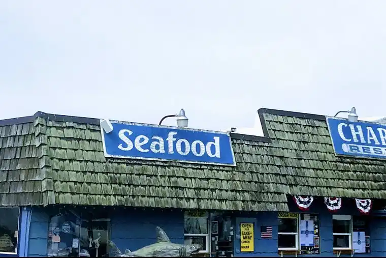
Chart Room Restaurant storefront in Crescent City, California, with a blue Seafood sign above the shingled facade

Chart Room Restaurant

Our Crescent City harbor pick. Chart Room sits on the waterfront at the harbor — a classic seafood spot with views over the boats. We recommend it when you want dinner by the water.

Crescent City Harbor · Seafood

130 Anchor Way, Crescent City, CA 95531

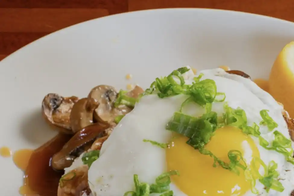
Fried egg topped with sliced green onions beside mushrooms and brown sauce at House of Howonquet, Lucky 7 Casino in Smith River, California

House of Howonquet at Lucky 7

Closest to us. House of Howonquet is the full restaurant at Lucky 7 Casino & Hotel in Smith River — a large dining room with classic American breakfast, lunch, and dinner. When we are tired and do not want the drive up to Brookings, this is where we go.

Smith River · Lucky 7 Casino & Hotel · American

350 N Indian Rd, Smith River, CA 95567

Lucky 7 dining

Brookings and Crescent City both have many other restaurants in different styles. We suggest checking Google Maps or Yelp for what fits your night.

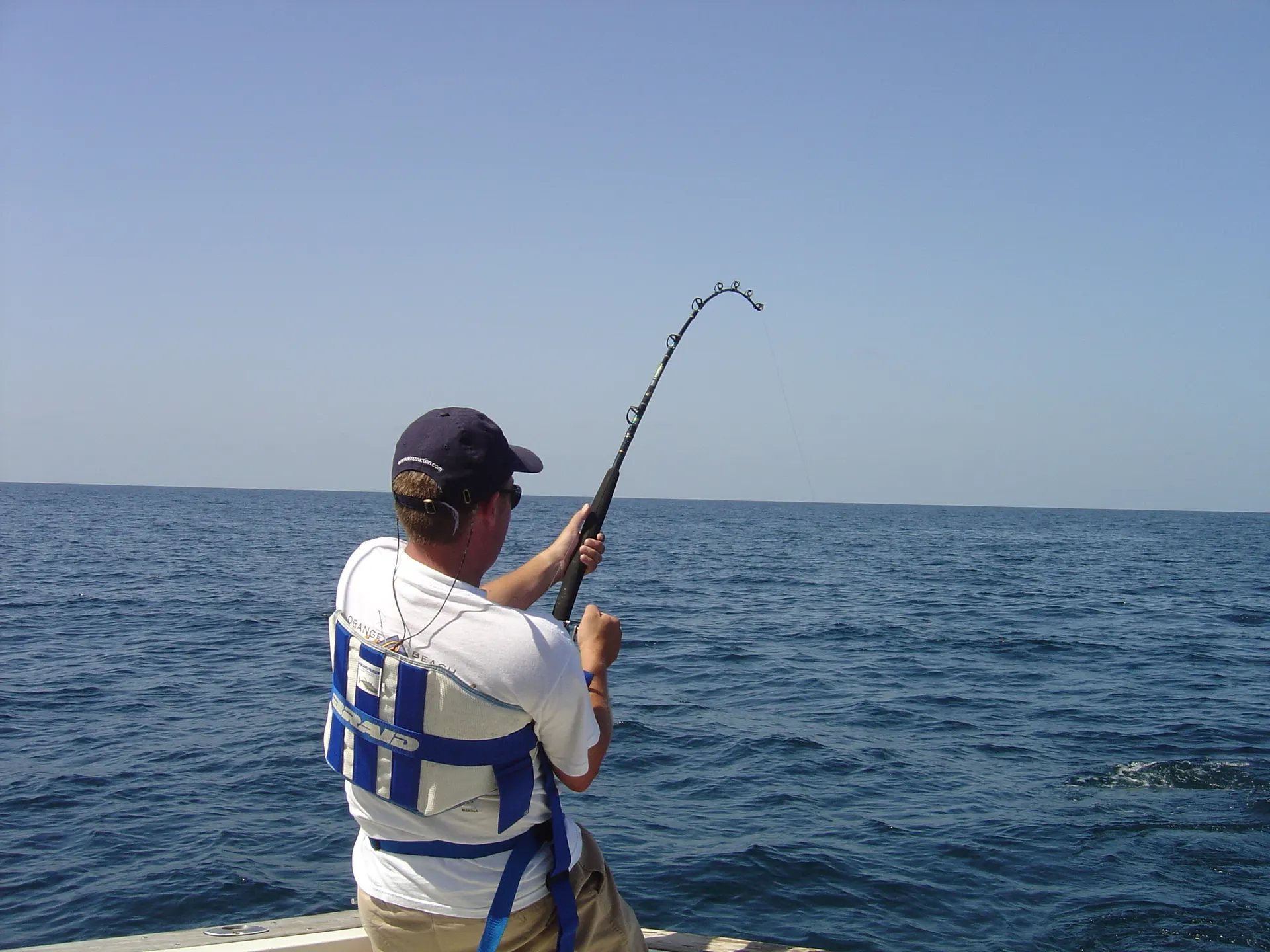
Angler deep-sea fishing from a boat on open ocean

Brookings Harbor

Charter a boat (if the ocean agrees)

Ocean fishing out of Brookings Harbor is a real day trip from here — rent a seat on a charter, not just stare at the water. The Port of Brookings-Harbor sits at the mouth of the Chetco River in Brookings / Harbor, Oregon, roughly a half hour north of us. The port’s own pages call the area a fisherman’s paradise, with ocean fishing available most of the year and guide services and charters most of the year too. Boats commonly target rockfish (snapper), lingcod, Chinook and coho salmon when those seasons are open, plus halibut, albacore, and crab when the year allows. Seasons and fish lists below are the companies’ and the port’s public descriptions — not a promise you will catch them. Catch rules follow ODFW for that year.

CC BY-SA 3.0 — Lsuff. Deep-sea fishing, Gulf of Mexico (2004).

Book ahead when you can; popular days fill, and captains cancel when the bar or ocean is unsafe — even if the beach looks calm. Bring a valid Oregon fishing license, and any salmon or halibut tag the trip needs. Some boats sell day licenses at the harbor. Always recheck that year’s ODFW rules before you go.

Brookings Fishing Charters

Daily charters from the Port of Brookings, with bait and tackle included on their trips. They describe a year-round local fleet — custom six-pack boats plus a larger party boat — and a booking office on Lower Harbor Road. Their public pages focus on ocean king salmon, light-tackle lingcod and rockfish, and halibut when that season is open.

16399 Lower Harbor Rd, Suite B, Brookings, OR 97415

(541) 813-1082 · (206) 388-8988

They describe ocean Chinook from early May to Labor Day, plus about two weeks of trophy fish at the Chetco mouth in October; lingcod on the shallow spawn in March–May; rockfish year-round; halibut when the season is open; crab too. Treat that as their typical-year description, then check ODFW before you book.

Brookings Fishing Charters

Tidewind Sportfishing

Also on Lower Harbor Road at the Port of Brookings-Harbor. Their site calls them a family-run charter service since 1975, with U.S. Coast Guard–inspected vessels and 100-ton Master captains. Trip types on their rates page include half-day bottom fishing for rockfish and lingcod, salmon, salmon-plus-bottom combos, and albacore when the fish are close enough to run.

16340 Lower Harbor Rd #116, Brookings, OR 97415

(541) 469-0337

Bottom fish, salmon, combo, and late-summer albacore are the trip types on their rates page. Open days still follow the year’s regulations — not a fixed calendar we control.

Trips and rates

More charter and guide boats leave from the same harbor — the City of Brookings and the Port of Brookings-Harbor list several publicly. Other public pages also mention Wild Rivers Fishing and Crescent City’s Steve Huber, who also runs Brookings and Gold Beach. Don’t assume they are the same company.

Two lighthouses, two moods

Walk a tide, or fly the Dragon Rocks

Battery Point is a walk at low tide. St. George Reef is a helicopter, and only when the weather behaves. Tour days move. Check the group that actually runs the trip.

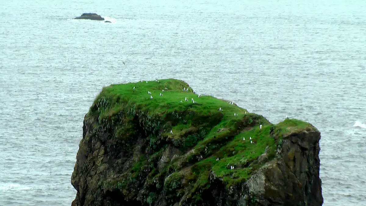
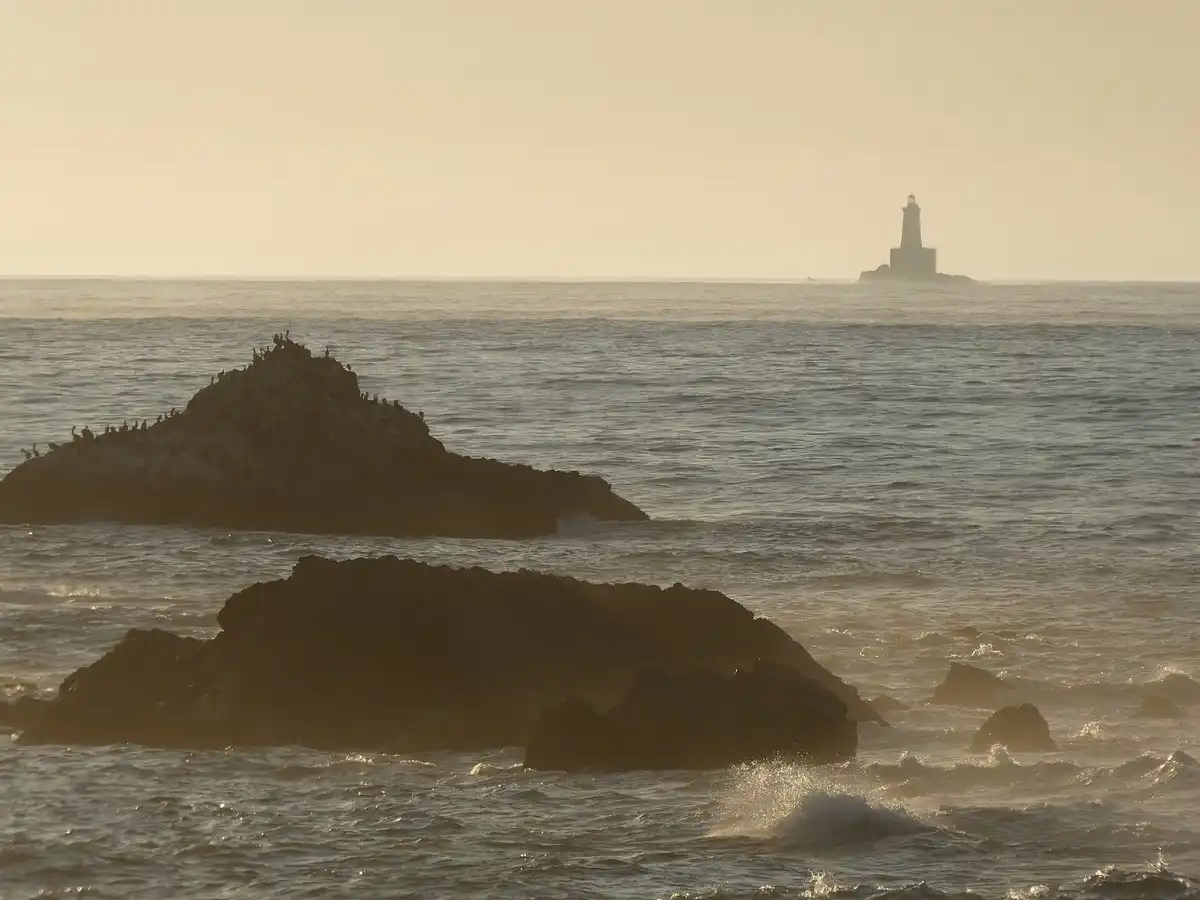
St. George Reef Lighthouse on its offshore rock

St. George Reef Lighthouse

Run by the St. George Reef Lighthouse Preservation Society, a 501(c)(3). The tower stands about 6–8 miles off Crescent City on Northwest Seal Rock, the Dragon Rocks. You only get there by helicopter, and fog and wind cancel plans. The 1865 Brother Jonathan shipwreck pushed the project. Construction ran about 1881 to 1891, it was first lit on October 20, 1892, and the Coast Guard left the station in 1975. The Fresnel lens is with the Del Norte Historical Society.

The helicopter tour schedule may change. Check the Preservation Society site for current tour days.

(707) 273-1905

Fog and wind cancel flights. Don’t treat an old posted month as a promise — the society site is the schedule.

CC BY-SA 4.0 — Raquel Baranow

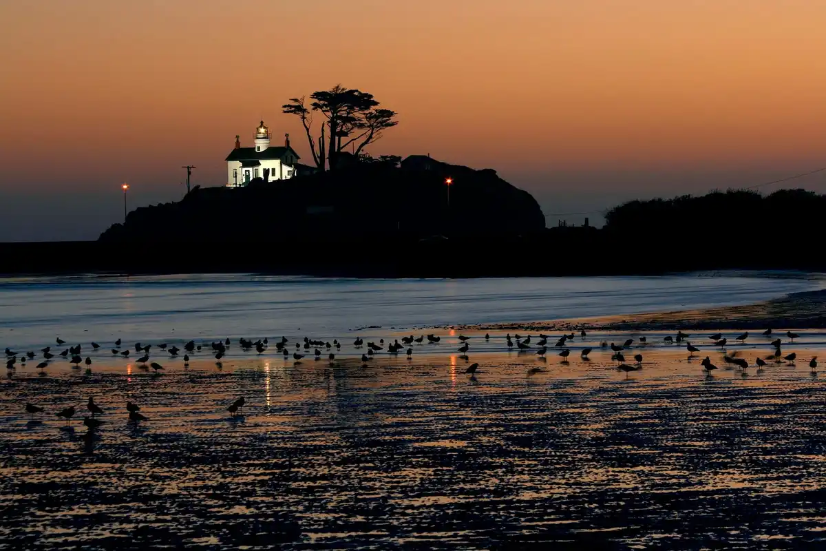
Battery Point Lighthouse in Crescent City

Battery Point Lighthouse

At the end of Lighthouse Way in Crescent City. It sits on a tide island, so you walk out only at low tide. First lit December 10, 1856. The tower and museum are open for visits when the tide allows.

April–September, daily 10am–4pm. October–March, weekends 10am–4pm. Always tide permitting.

(707) 464-3922

If the tide is in, the island is not a suggestion. Come back when the path is dry.

CC BY-SA 3.0 — Mixologistmike

Fly closer

Three airports, three kinds of easy

Drive times are OSRM estimates to 181 Salmon Harbor Road, Smith River, checked for this page on November 5, 2026. Traffic and road work win. Use the live map link.

CEC

Del Norte County Regional Airport

Airlines. Advanced Air (Essential Air Service)

Oakland (OAK), daily round trip. Hawthorne (HHR) in the Los Angeles area is mostly Thursday and Sunday, with seasonal adds and cuts, plus a reserved free LAX shuttle. Avis and Budget are on site, and the airport says parking is free.

About 18.2 miles · About 29 min

29

Schedule read from the airport site and Advanced Air’s Crescent City page, from an October 2026 timetable.

ACV

California Redwood Coast–Humboldt County

Airlines. United, Breeze, Alaska

The airport site lists nonstop Denver, Los Angeles, San Francisco, Burbank, Las Vegas, Seattle, and Provo. Address: 3561 Boeing Ave., McKinleyville, CA 95519. Phone 707-839-5401.

About 86.3 miles · About 119 min

119

This follows the flyacv.com summary. Individual airline timetables were not checked flight by flight.

MFR

Rogue Valley International–Medford

Airlines. Alaska, Allegiant, American, Delta, United

The airport’s direct-flight table lists Phoenix; Seattle, Los Angeles, Portland, and San Diego; Seattle and Salt Lake City; San Francisco and Denver; Las Vegas and Santa Ana (Orange County).

About 114.1 miles · About 2 hr 40 min

160

Mostly mountain highway. Recheck the winter schedule on the airport site.

Before you vanish into the trees

The boring bits that save the day

Check NPS Current Conditions before a trail day. Downed trees, seasonal bridges, and closures move.

Fern Canyon needs a summer permit or vehicle reservation. Check the official park site for the current dates. Davison Road limits vehicle size and does not allow trailers.

Boy Scout Tree Trail had a downed tree near 1.75 miles as of August 2026. Recheck before you count on a clear path.

Don’t leave valuables in the car at trailheads. NPS calls out theft at Boy Scout Tree and Damnation Creek.

Tall Trees needs a free permit all year for parking and the locked access road. No RVs over 21 feet and no trailers.

Boardman stops include cliffs and sneaker-wave beaches. Use the Oregon State Parks brochure and the tide.

The St. George Reef helicopter tour schedule may change, and weather can cancel the flight. Check the Preservation Society site before you plan on it.

Ranger kayak trips are a summer maybe. The 2025 page closed the season early. Ask the NPS page about 2026.

Charter seasons and target fish are company and port descriptions. ODFW rules, ocean conditions, and the actual bite are separate things.

Airport drive times are estimates, not a promise. Open the live map the morning you land.
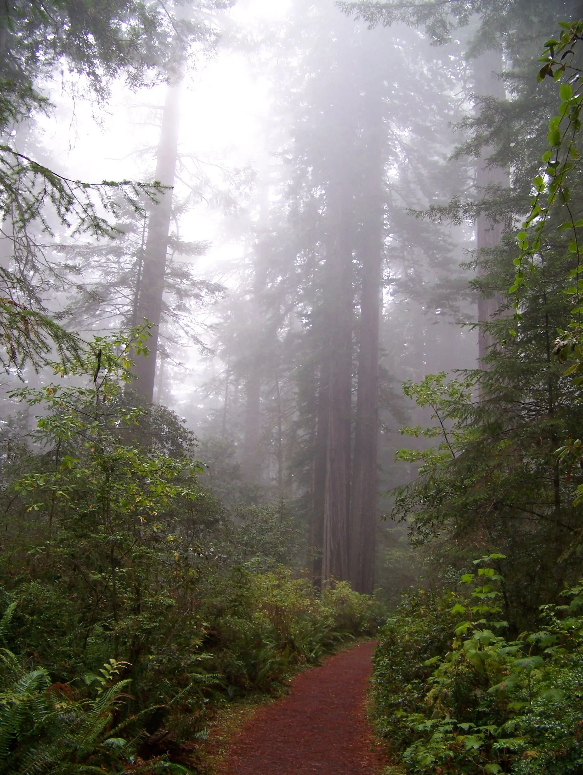
Photo credits

Every photo on this page is public domain or a Creative Commons image. Charter and kayak company photos are not used here — follow the buttons to their sites.

  • Fog in a coast redwood forest. CC BY-SA 4.0 — Dwatsonfam Source
  • Sea stacks at Arch Rock, Samuel H. Boardman State Scenic Corridor. CC BY 2.0 — Rick McCharles Source
  • Rapids on the Smith River under a forested slope. CC0 — Z3lvs Source
  • Official north district map of Redwood National and State Parks. Public domain — National Park Service. North district, from Klamath north, including Jedediah Smith and Del Norte. Source
  • Official overview map of Redwood National and State Parks. Public domain — National Park Service. Full park overview. Source
  • Official south district map of Redwood National and State Parks. Public domain — National Park Service. South district. Source
  • Forested slope above Smith River rapids. CC0 — Z3lvs. Smith River National Recreation Area. Source
  • North Fork of the Smith River near Hiouchi. CC BY-SA 3.0 — PGHolbrook Source
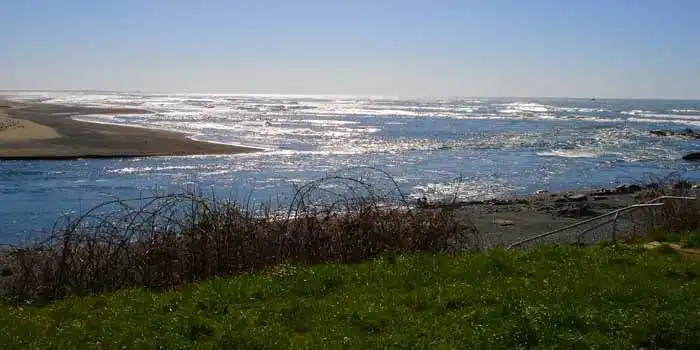
  • Mouth of the Smith River. CC BY-SA 3.0 — BigT67. Low-resolution reference photo of the river mouth. Source
  • Jedediah Smith Redwoods State Park. CC BY-SA 3.0 — Chmee2 Source
  • Del Norte Coast Redwoods State Park. CC BY 2.0 — Katie Thebeau Source
  • Prairie Creek Redwoods State Park. CC BY-SA 2.0 — Ken Lund Source
  • Redwood National Park. Public domain — National Park Service Source
  • Stout Memorial Grove. CC BY-SA 3.0 — Chmee2 Source
  • Grove of Titans. Public domain — Grogan, Brian (HAER). Stand-in from Howland Hill Road Source
  • Boy Scout Tree Trail. CC BY 2.0 — Chris Rycroft Source
  • Howland Hill Road. Public domain — Grogan, Brian (HAER) Source
  • Simpson-Reed Trail. CC BY-SA 3.0 — Chmee2. Stand-in from Stout Grove Source
  • Hiouchi Trail. CC0 — Z3lvs Source
  • Damnation Creek Trail. CC BY 2.0 — Katie Thebeau Source
  • Enderts Beach. Public domain — Grogan, Brian (HAER) Source
  • Fern Canyon Loop. CC BY-SA 2.0 — Ken Lund Source
  • Tall Trees Trail. Public domain — Redwood National and State Parks Source
  • Lady Bird Johnson Grove. Public domain — NASA Goddard Space Flight Center Source
  • Arch Rock. CC BY 2.0 — Rick McCharles Source
  • Natural Bridges. CC BY 3.0 — regstrat Source
  • Whaleshead. CC BY 4.0 — Gary Halvorson, Oregon State Archives Source
  • House Rock. CC BY 2.0 — Rick McCharles Source
  • Cape Ferrelo. CC BY-SA 2.0 — Dougtone Source
  • Secret Beach. CC BY 2.0 — Oregon Department of Transportation Source
  • St. George Reef Lighthouse. CC BY-SA 4.0 — Raquel Baranow Source
  • Battery Point Lighthouse. CC BY-SA 3.0 — Mixologistmike Source
  • Black Trumpet Bistro. From our screenshot of the Black Trumpet Bistro website. Source
  • Chart Room Restaurant. From our Google Maps screenshot; original photographer not identified in the screenshot.
  • House of Howonquet at Lucky 7. From our screenshot of the Lucky 7 Casino dining website. Source
  • Angler deep-sea fishing from a boat on open ocean. CC BY-SA 3.0 — Lsuff. Deep-sea fishing, Gulf of Mexico (2004). Source